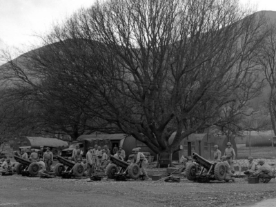
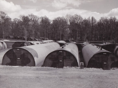
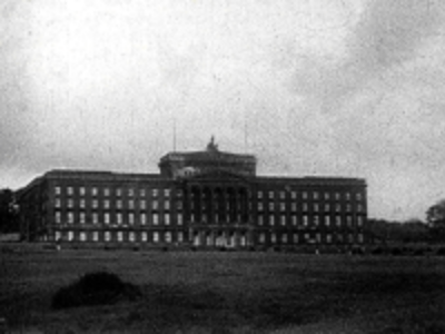
The main German thrust was expected to be a seaborne landing along the southwest coast of England, however Northern Ireland was vulnerable to diversionary attacks from German-occupied Norway, so the defences here could not be ignored.
Large tracts of the north’s coastline were unsuitable for amphibious landings, but eight stretches of gently sloping beaches were identified as possible landing zones. These were Magilligan, Portstewart, Portrush, Cushendun, Cushendall, Carnlough, Strangford Lough, and Dundrum/Murlough.
These beaches were fortified with the construction of reinforced concrete pillboxes surrounded with barbed wire entanglements and supporting infantry trenches. The pillboxes were armed with machine guns and sited with interlocking fields of fire which created a lethal killing zone along the beach for infantry trying to cross it. Further defences were built to guard the beach exits to contain invading forces trying to push inland.
Known as the coastal crust, these beach defences were not designed to stop an invader at the water’s edge, but to delay them just long enough to allow a mobile force to be assembled inland. It was intended that a counterattack by these forces would destroy the invaders rather than the men in the pillboxes. However, layers of concrete and steel were used to maximise their effectiveness and resist the firepower of the invading forces. One sobering thought must have remained with the men inside. Once they were engaged there was very little chance that the defending troops could escape or withdraw.
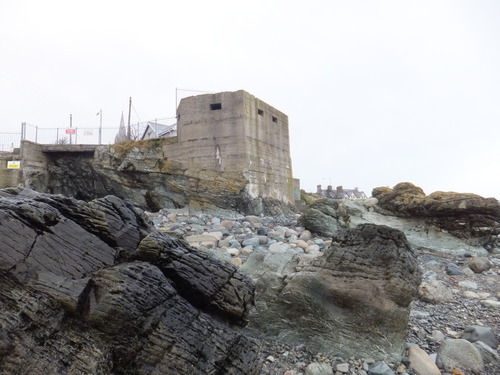
Beach obstacles were also erected to slow the advance of enemy forces. These could be simple barbed wire entanglements and beach scaffolding, which could physically block an attacker. There was also concern that long expanses of beach could be used to land airborne troops in gliders. Therefore, thick poles (which could be mined) were erected on selected beaches, making any attack from the air prohibitively hazardous.
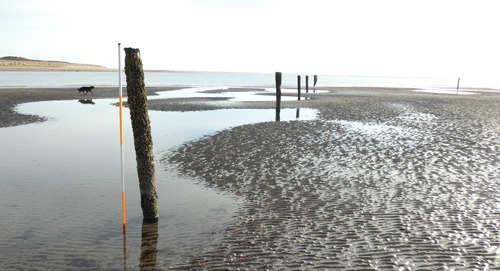
While the coastal crust was the first line of defence, a series of eight stop-lines were constructed inland to impede the advance of enemy forces. As with the beach defences, the troops manning them were ordered to hold or delay an enemy until a mobile counterforce could be deployed.
Due to limited resources, Lines A and B were built along the River Bann and Newry Canal as military planners intended to use these waterways as obstacles to an enemy advance. A demolition scheme was developed that would have seen all but a few key crossings destroyed. It was at these remaining bridges that defences were concentrated providing a continuous line of defence from the Bannmouth on the north coast, all the way to Carlingford Lough at the border with Éire. Lines C to H were a sequence of lines falling back to the Belfast Defence Scheme, which was a perimeter of defensive posts, fieldworks, observation posts and roadblocks around the city.
After the shock of Dunkirk and the invasion scare had subsided, it became apparent to the British High Command that stop-line defences were not tenable. Apart from the demands in manpower needed to defend the lines, it was realised that any penetration of the line immediately neutralised its strength. Enemy forces could break out into rear areas compromising the security of the entire line.
Consequently, defensive policy shifted to a network of garrison towns and nodal points. This saw defences concentrated in built-up areas and key road junctions along an enemy’s anticipated line of advance. Twenty-seven such points were designated in Northern Ireland, however, pressure from post-war reconstruction and redevelopment has ensured that almost all the defences in urban areas have been removed. Only a few of the nodal point defences remain, the most prominent being the pillbox in Downpatrick Street, Rathfriland, that covers the southern approach to the town. Nevertheless, the location of defences in rural areas and more-isolated beauty spots has ensured that many survive to this day.
The Pillboxes Today
The majority of remaining anti-invasion pillboxes are to be found along the beaches on the north coast, Dundrum, Murlough and along the Newry Canal. Examination of these structures gives us some idea of how they were built and just how they were planned to be used. Those that remain are built of reinforced concrete with two or three embrasures which would have mounted a machine gun, normally a Vickers gun, or a lighter Bren gun mounted on a tripod. Early embrasures were just small square openings, but these were improved with the development of 'staircasing'. This presented a flat surface to incoming fire, preventing ricochets from entering the position.
Steel shutters can often still be found mounted inside the embrasures and these features are a sobering reminder of how dangerous pillboxes could be. They were fitted to prevent gunfire, but more ominously, flamethrowers from killing the crew inside by deflecting the flame jet. It did not, however, prevent the flames from consuming the oxygen inside the position, thereby, suffocating the crew. Grim indeed.
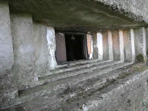
Pillboxes today appear to stand alone on the beaches and river/canal crossings, but we should remember that they were not built-in isolation. Barbed wire entanglements and fire trenches manned by infantry surrounded these structures and were vital to defending the position. However, their apparent strength obscures a critical vulnerability, narrow fields of view. Thick walls and narrow viewports inevitably restricted the crew’s field of vision and pillboxes relied on troops outside the position to secure their flanks and rear. Indeed, by the end of the war, there were standing orders that pillboxes were only to be used to shelter from artillery fire and left immediately after. The perceived safety of pillboxes could cause them to become death-traps for troops sheltering inside, as they tended to attract incoming fire.
Pillboxes came in two distinct specifications: bullet-proof or shell-proof. The first had walls up to 30-61 centimetres thick, whereas the latter needed to be 62-138cm thick to resist heavy weapons fire. All the remaining pillboxes on the coastline are bullet-proof and those remaining on Stop Line B between Portadown and Newry are of the shell-proof variety.
Built along the Newry Canal, they are clustered at three key crossing points at Scarva, Gilford and Dynes Bridge whilst others cover the rear areas of the line and the approaches to Portadown, which was designated a garrison town. They are largely similar in design, with two main embrasures and an observation loop normally mounted to the rear or side of the site depending on the surrounding topography. The structures are accessed by a single doorway at the rear, which would have had a steel door (though most were removed for scrap post-war) and protected by a concrete blast wall. There are platforms for mounting machine guns, and ammunition storage recesses. The walls have a maximum thickness of 138 cm, though the roofs are much thinner, approximately 30cm. This suggests they were designed to resist direct, low-angle heavy weapons fire, such as from tanks, but not high angle plunging fire from artillery and mortars, as a precise hit from indirect fire was unlikely.
In contrast to the stop-line defences, the pillboxes built along the coastline are much less heavily built. While they share many similar features, such as ‘staircased’ embrasures and steel shutters, their walls are much thinner, usually around 50cm thick. This is because they were not expected to face the kind of heavy weapons deployed against stop-lines. Amphibious forces (early in the war) could only deploy light support weapons, moreover, naval gunfire had difficulty targeting small coastal structures and therefore coastal pillboxes did not need to be as solidly constructed as their inland counterparts. None of the surviving pillboxes on the coast of Northern Ireland appear to have been armed with anything more powerful than machine guns, demonstrating they were there to stop nothing heavier than an infantry assault.
The Future of Pillboxes in Northern Ireland
The pillboxes that remain today are just a fraction of the many hundreds that were constructed during the Second World War. Post-war, they were viewed as an ugly reminder of a traumatic time of war and most were removed to return the landscape to its more peaceful normality. Yet, with almost 80 years since the end of the war, they are perhaps viewed with more sympathetic, nostalgic eyes as the conflict slips ever more out of living memory. Consequently, many of those remaining have been given statutory protection as scheduled monuments, ensuring they remain as (literally) concrete links to the past, and reminders of the traumatic events and sacrifices of the Second World War.
About the Author
Dr James O’Neill is currently in the final stages of Phase 2 of the Defence Heritage Project launched by the Historic Environment Division. Its aim is to record and conserve our defence heritage. A web-based map application of Defence Heritage can be found online: Historic Environment Record of Northern Ireland - Historic Map Viewer
Dr James O’Neill can be followed on Twitter
All images courtesy of DfC:HED.


